Japan / Sanyōdō · Bizen Province · Transport · History
Sanyōdō: Eight Provinces, a Road, and an Inland Sea
From an ancient administrative circuit to the Saigoku highway, the history of Sanyōdō reveals how relay stations, waterways, and the terrain of Bizen connected Japan.
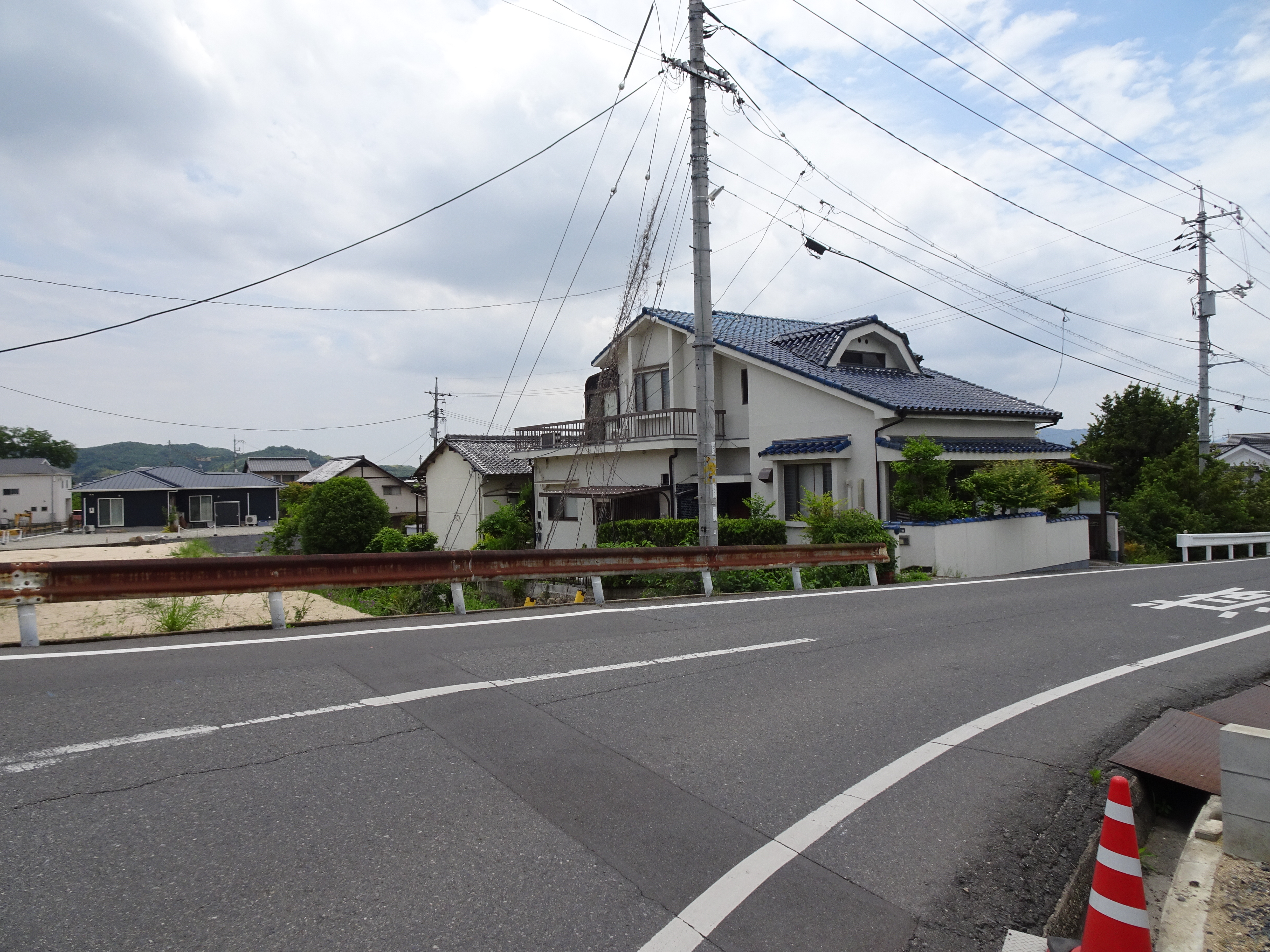
A road is a line between places. Yet once we ask who used it, what it carried, and who maintained it, that line begins to reveal the workings of an entire society.
Sanyōdō was such a road. It stretched westward from the capital, crossed Bizen, and supported travel toward Kyushu. But to understand it simply as an old highway is to miss half its meaning. The name also designated a broad region encompassing several provinces.
One road, eight provinces
Sanyōdō was one of the seven circuits in the ancient state’s system of five central provinces and seven circuits, known as the Goki Shichidō. By the time of the Engishiki, a compilation of court regulations, it comprised eight provinces: Harima, Mimasaka, Bizen, Bitchū, Bingo, Aki, Suō, and Nagato.
On a modern map, this broadly corresponds to an area extending from western Hyogo through Okayama and Hiroshima to Yamaguchi. Provincial and prefectural boundaries do not always coincide, however. An old province cannot simply be substituted for a present-day administrative unit.
The inclusion of inland Mimasaka is especially important. Created from part of Bizen in 713, it belonged to the circuit without being traversed by the main relay highway. The provinces along the trunk road and those within the administrative circuit were not identical. Sanyōdō was both a line and an area.
Bizen, Bitchū, Bingo, and the territory that later became Mimasaka shared an older connection with the region of Kibi. Sanyōdō did not introduce order into an empty landscape. It connected places that already had inhabitants, regional powers, and maritime links within a new administrative and transport system.
Why did the road to Dazaifu matter?
It is difficult to assign the establishment of Sanyōdō to a single year. The Ministry of Land, Infrastructure, Transport and Tourism places the major development of ancient trunk roads in the nation-building process of the later seventh century, during the reigns of Tenji and Tenmu. Roads developed alongside institutions, rather than appearing fully formed after a single decree. MLIT, historical infrastructure overview
Dazaifu stood at the western end of this important axis of communication. As a major center concerned with the governance of Kyushu and foreign relations, it needed more than a passable route to the capital. Orders, reports, and information about distant events required a dependable system of communication.
The relay network classified roads into three ranks, and Sanyōdō received the highest designation, tairo. Yet the entire journey to Dazaifu did not lie within the Sanyōdō administrative circuit: on Kyushu, it connected with part of Saikaidō. Distinguishing a regional division from a long-distance itinerary clarifies what it means to say that the road linked the capital and Dazaifu. MLIT, ancient roads; Sagamihara City Sagami-Ono Library research response
Relay stations and the work of communication
The ancient umaya, or relay station, was neither a modern railway station nor an Edo-period post town. It supplied fresh horses to official messengers and formed part of the road’s communication system.
MLIT’s Hyogo National Highway Office describes stations on Sanyōdō as spaced approximately sixteen kilometers apart. The standard provision for a major-road station was twenty horses, but actual allocations varied. We should not imagine that every station always possessed exactly the same number. Hyogo National Highway Office, roads of the past
Horses alone could not keep the network functioning. People had to feed and care for them, receive messengers, and maintain the route. The system that allowed decisions made in the capital to reach distant places depended on work performed along the road. Its history concerns not only infrastructure, but also the society that sustained it.
In Bizen, river crossings reshaped the route
Present-day National Route 2 or the Sanyo Expressway cannot simply be projected backward onto ancient Bizen. The road’s alignment and the centers it served changed between antiquity, the medieval period, and early modern times.
According to Okayama City’s historical guide, the ancient route approached from the area of present-day Akaiwa, crossed the Asahi River at Musa, and continued toward Tsudaka. A branch from Musa served the Bizen provincial headquarters, thought to have stood near present-day Kokufuichiba. That branch subsequently became part of the reorganized medieval route. Okayama City, medieval Sanyōdō
At the eastern entrance to Bizen, Mitsuishi occupied an important position on the route across Funasaka Pass into Harima. Okayama Prefecture describes Mitsuishi Castle as traditionally having been established in 1333 by Itō Yamato Jirō to block Sanyōdō. A road that supported government and commerce could also become a strategic point to control. Okayama Prefecture, Mitsuishi Castle ruins
Where could a river be crossed? Which pass led through the hills? Which town or seat of power was the destination? These physical and political conditions are essential to understanding the road’s history.
Beside the land route lay a sea route
Transport around the Seto Inland Sea cannot be explained by roads alone. In the Heian period, travel between the capital and Dazaifu could also involve ports along the Yodo River, Osaka Bay, and a succession of Inland Sea ports. A public-library research response brings together documentary sources describing these maritime routes. Sagamihara City Sagami-Ono Library research response
A road’s importance does not mean that all freight traveled over it. Maritime transport suited large, heavy cargoes, while overland routes supported people and official communication. The sea beside Sanyōdō was not an empty space separating destinations. It was another transport network.
Nor did the medieval weakening of the ancient relay system mean that movement between regions ceased. Relations among territorial rulers, checkpoints, ports, and markets changed, and people and goods continued to move through different arrangements. The decline of an institution must not be mistaken for the disappearance of traffic.
The Saigoku highway and the rise of castle towns
In early modern times, the westward trunk route was known by names including Saigoku Kaidō, Saigokuro, and Chūgokuro. This was more than a change of name. The development of castle towns and coastal settlements altered its alignment.
Hiroshima provides a clear example. The city explains that the earlier route had avoided unstable ground around the mouth of the Ota River by making a substantial detour north. With the construction of Hiroshima Castle and its town in the late sixteenth century, an east–west route through the settlement became the highway. The convergence of road and water transport changed the town’s position within a wider network. Hiroshima City, introduction to the Saigoku highway
The Edo-period highway supported official shogunate travel and the journeys of domain lords under the alternate-attendance system, while continuing to coexist with maritime transport. Its high status should not lead us to imagine that all coastal rice and regional products moved overland. The rank of a road and the volume of freight it carried are different questions.
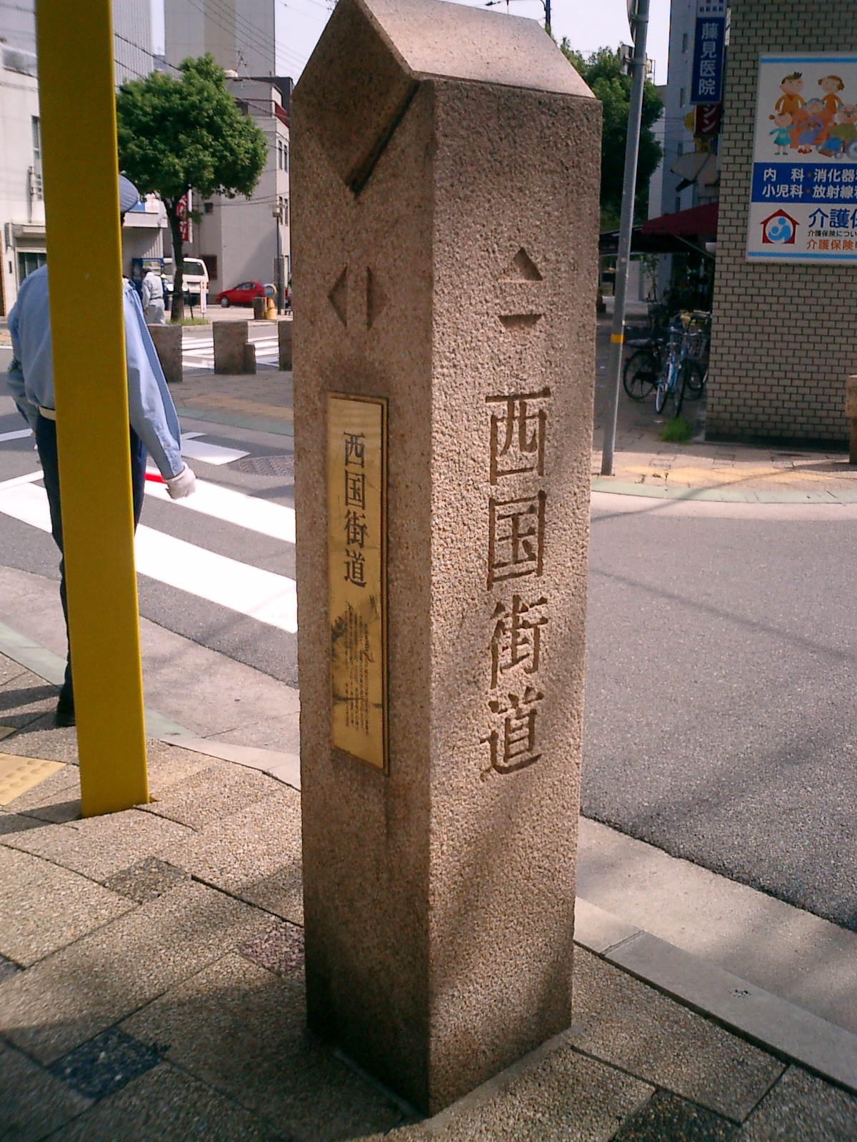

Reading a road means reading relationships
When exploring Sanyōdō, it is more revealing to look for overlapping layers of transport history than to imagine a single road surviving unchanged from antiquity. Which period does a marker recall? Did a route serve a provincial headquarters or a castle town? How did it connect with a nearby river or port?
Bizen existed within these relationships. Between the capital and the west, it encompassed passes and rivers while opening onto the Inland Sea. That geography connected the region to a wider world, but also brought the obligations of maintaining traffic and the tensions of strategic importance.
Sanyōdō was more than a road for reaching distant places. It offers a way into the history of how a state connected its regions—and how people used land and sea to move between them.
Related reading: Bizen Province, Part One: The Eastern Province of Ancient Kibi
Sources and Image Credits
- Encyclopedic and historical-dictionary entries on Sanyōdō by Takayuki Kameda, Hiroshi Tanami, and Sakuji Doi, supplied by the reader. This article uses an original structure and wording.
- MLIT: historical infrastructure development; ancient roads.
- MLIT, Hyogo National Highway Office: roads of the past.
- Okayama City: Medieval Sanyo Road.
- Okayama Prefectural Ancient Kibi Cultural Properties Center: Mitsuishi Castle ruins.
- Sagamihara City Sagami-Ono Library: routes used by Heian-period officials traveling to Dazaifu, National Diet Library Collaborative Reference Database.
- Hiroshima City: introduction to the Saigoku highway.
- Opening photograph: Evans no Hisho (romanized contributor name), May 28, 2023, old Sanyōdō in Kawabe, Mabi, Kurashiki, CC BY-SA 4.0. Original image used. Display framing and color may vary with the site's layout; those image presentations retain the same license. The second photograph is credited in its caption.
.jpg)
Sources checked September 27, 2026. The supplied references give differing totals for stations and station horses. Because their counting scope has not been established, this article does not give an aggregate total.